

BOOK THIS TOUR
Duration of climb: 6 – 7 days
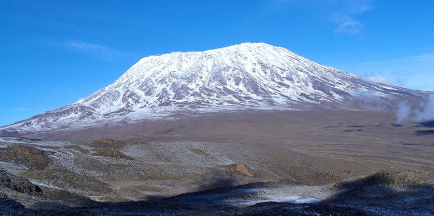
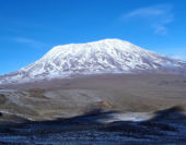
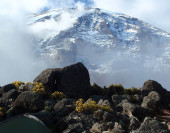
The Lemosho route is an unspoilt, remote, little used and beautiful way up to the Shira Plateau. The route is one of the few where groups may be accompanied on the first day by an armed ranger, as the forests around the Lemosho Glades are inhabited by buffalo, elephant and other wildlife.
The minimum duration for the Lemosho route is 6 days, however we strongly recommend hiking the route in 7 days. The additional 7th day will give your body more time to acclimatize, reducing the effects of altitude sickness and give you more time to rest before attempting the summit.
The main itinerary differences between the Lemosho 6 day and 7 day routes are as follows:
Day 1 to 3: Are similar for both routes.
6 Day Lemosho route:
Day 4: Start hiking from the Barranco camp at 8:00am and hike approximately 10km to Barafu camp stopping at Karanga camp for lunch. You can expect to arrive at Barafu camp by 16:00pm to 17:00pm. Enjoy dinner, prepare your summit gear and rest till midnight when you will be woken up for the start of the summit attempt.
Day 5: Start the summit attempt just after midnight and expect to reach the summit by sunrise. Descend to Barafu camp and then to Mweka camp which you should reach by around 16:00pm.
7 Days climb:
Day 4: Start hiking from the Barranco camp at 8:00am and hike approximately 6.6km to Karanga camp, expect to arrive around 12h00 for lunch, dinner and overnight. (An after lunch acclimatization hike could be a good idea should you feel up to it)
Day 5: Hike 3.3km from Karanga camp to Barafu camp. You can expect to arrive to Barafu by around 11:00am which will allow much more time to rest, enjoy dinner, prepare your summit gear and rest till 23:30pm when you will be woken up for the start of the summit attempt. (An after lunch acclimatization hike could once again be a good idea should you feel up to it)
Day 6: Start the summit attempt just after midnight and expect to reach the summit by sunrise. Descend to Barafu camp and then to Mweka camp which you should reach by around 16:00pm.
Day one – Londorossi Gate (2100m) – MtiMkubwa camp (2 821m)
Hiking time: 3 ½ hours
Distance: Approximately 5.4 km
Habitat: Montane forest
After breakfast drive to the Londorossi Park Gate (2100m). The guides and porters prepare and pack the supplies and your equipment at the village. Following registration you will continue by vehicle, a further 12km on a forest track that leads to the Lemosho starting point (2244m). This can take anywhere from 45 minutes to 1 ½ hours, depending road conditions. The road to the Lemosho starting point is particularly inaccessible during the wet season and climbers should be prepared to walk the final 2-5 kilometres of the road, following heavy rains. The journey time to reach the start point is quite long and joined with the possibility of not reaching the end of the road by vehicle, head torches may well be needed to reach Forest camp on day 1.
Trek from the Lemosho start point (2424m) to the Forest camp (2821m) where you spend your first night in the mountain. You are advised to stop regularly today and to move quietly in the hope of sighting wildlife near the trail. Sightings of small antelope are virtually unique to the Lemosho and Rongai routes.
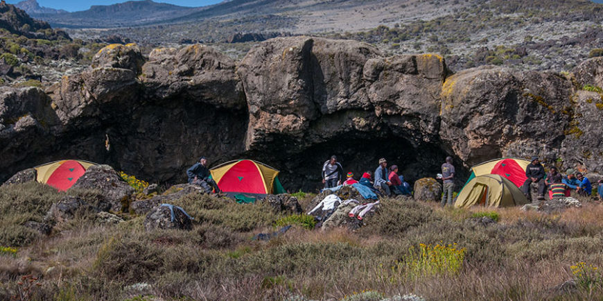
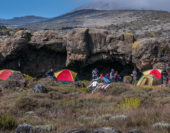
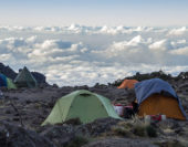
Your porters (arriving at the camp site long before you) will have your tent set up on your arrival. In the evening the porters will bring a small bowl of washing water to your tent and the cook will prepare dinner, before you retire to your tent for the night. Night temperatures can already drop to freezing point at this campsite.
Day two – Forest camp (2821m) – Shira 2 Camp (3875m)
Hiking time: 8 hours
Distance: 15.6 km
Habitat: Moorland
You rise early at Forest camp and, after breakfast, you trek a hour or so to the end of the forest and then the trail gradually steepens and enters the giant heather moorland zone. Several streams are crossed. After 8.1 km we reach Shira 1 camp (3504m) located on the Western edge of the Shira Plateau where we stop for lunch.
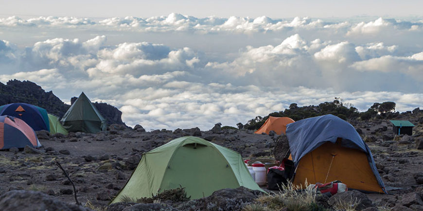
After lunch we hike across the Shira plateau for another 7.5km to the Shira 2 Camp, situated on the moorland meadows (3875m). By now you will be able to see, in an easterly direction, the Western Breach with its stunning glaciers. The porters will provide a small bowl of washing water to each hiker, before the cook serves dinner. The night at this exposed camp will even be colder than the previous night, with temperatures dropping to well below freezing.
Day three – Shira 2 Camp (3875m) – Lava Tower (4642m) – Barranco camp (3984m)
Hiking time: 8 hours
Distance: Approximately 10.3 km
Habitat: Semi desert
Trek from Shira 2 Camp east towards Lava Tower (4642m). As the hike progress the surrounding area turns into a semi desert and rocky landscape. Shortly before reaching Lava Tower the Lemosho route links up with the Machame route. The last part of the hike, (just before reaching Lava Tower), is definitely the toughest part of your hike so far. It is normally around this point, where for the first time, some hikers will start to experience the symptoms of breathlessness, irritability and headaches. You will arrive in time for lunch at Lava Tower (4 642m) after hiking a distance of about 6.6 km.
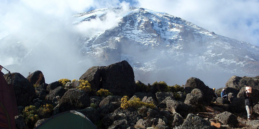
After lunch you descent again by almost 680m to the Barranco camping area and after reaching the high altitude of 4600m at Lava Tower, the true acclimatisation benefit of this day becomes clear. This descent to Barranco camp takes about 2 hours (3.3 km) and offers great opportunities to take some beautiful photographs of the Western Breach and Breach Wall. The descend is tiring and should not be underestimated. The camp is situated in a valley below the Breach and great Barranco Wall, which should provide you with a memorable sunset while you get some much needed relaxation before dinner.
Day four – Barranco camp (3984m) – Barafu camp (4681m)
Hiking time: 8 hours
Distance: 9.4km
Habitat: Alpine desert
After spending a night at the great Barranco Wall (a very imposing sight at first), you make your way up this awesome looking obstacle, which in the end normally turns out to be easier than anticipated. Topping out just below the Heim Glacier, you will now appreciate just how beautiful Kilimanjaro really is. The route then heads down through the Karanga Valley over intervening ridges and valleys, and then joins up with the Mweka route. This is the preferred route down from the summit, so remember it. Turn left up the ridge and after another hour or so, you should reach Barafu Hut.
The last water stop on the route is the Karranga Valley, as there is no water available at Barafu camp. Barafu is the Swahili word for “ice” and it is a bleak and inhospitable camping area to spend the night. Totally exposed to the ever-present gales, the tents are pitched on a narrow, stony, and dangerous ridge. Make sure that you familiarize yourself with the terrain before dark to avoid any accidents.
The summit is now a further 1214m higher and you will commence with your final ascent attempt, the same night. Prepare your equipment, hiking poles and thermal clothing for your summit attempt. This should include the replacement of your headlamp and camera batteries and make sure you have a spare set available as well. To prevent freezing it will be wise to carry your water in a thermal flask. Go to bed at round about 19h00 and try to get some precious rest and sleep.
Day five – Summit attempt – Barafu camp (4681m)-Uhuru Peak (5895m)-Mweka (3090m)
Hiking time: 7 to 8 hours to reach Uhuru Peak, 6 to 8 hours to descend to Mweka Camp
Distance: Approximately 4.5 km ascent and 10.8 km descent
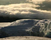
Habitat: Stone scree and ice-capped summit
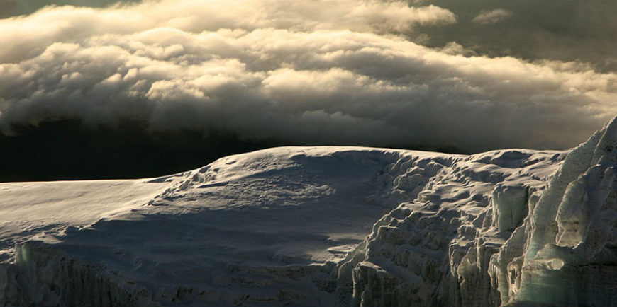
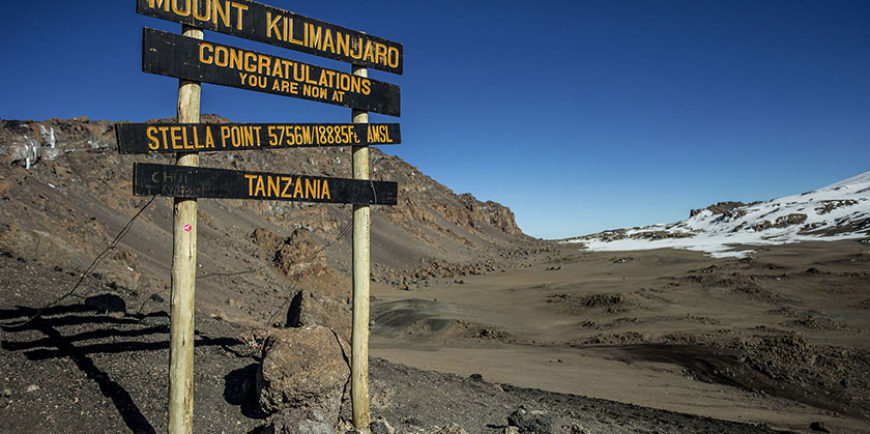
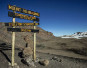
You will get up around 23h20, and after some tea and biscuits you shuffle off into the night. You will head in a north-westerly direction and ascend through heavy scree towards Stella Point on the crater rim. For many climbers the 6-hour walk to Stella point is mentally and physically the most challenging on the route. At Stella Point (5739m) you will stop for a short rest and will be rewarded with the most magnificent sunrise you are ever likely to see (weather permitting).
From Stella Point you will normally encounter snow all the way on your 2-hour ascent to Uhuru Peak. The time you will spend on the summit will depend on the weather conditions. Do not stop here for too long, as it will be extremely difficult to get going again due to cold and fatigue. Enjoy your accomplishment and a day to remember for the rest of your life!
The walk back to Barafu from the summit, takes about 3 hours. Here you will have a well earned but short rest and collect the rest of your gear, before heading down to Mweka hut (3090m). The route is not difficult and will take you down the rock and scree path into the moorland and eventually into the forest. The camp is situated in the upper forest and mist or rain can be expected in the late afternoon. Dinner and washing water will be prepared.
Day six – Mweka camp (3090m) – Mweka Gate (1641m)
Hiking time: 4 to 6 hours
Distance: Approximately 8.5 km
Habitat: Forest
After an early and well-deserved breakfast, it is a short 4 to 6 hour and scenic hike back to the Park gate. Some hikers do experience knee problems which could make the descend longer than planned.
At Mweka gate you sign your name and details in a register. This is also where successful climbers receive their summit certificates. Those climbers who reached Stella Point (5739m) are issued with green certificates and those who reached Uhuru Peak (5895m) receive gold certificates.
From the Mweka Gate you will continue down into the Mweka village, normally a muddy 3 km (1 hour) hike where you will be picked and taken toyour hotel.